Siobhan Treacy
Researchers from the University of Texas at Austin used a computer model to connect patterns between sedimentary deposits, shifts in climate and tectonic activity to understand the forces that shaped Earth and their implications on modern-day Earth.
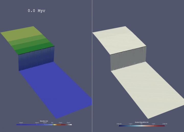
 A source-to-sink model illustrating changes in elevation (left) and erosion/deposition (right). Source: Jinyu Zhang/ The University of Texas at Austin
The team used an open-source computer program by Badlands to create a “source-to-sink” 3D model. The model tracks changes in precipitation, tectonic uplift and sea level. It also tracks how these factors influence erosion and deposition. Sedimentary basins provide clues about Earth’s past climate. Sediment supply is linked to environmental factors that influence sediment creation through erosion and sediment transport into a basin. Tectonic factors also influence sediment creation, but there is little known about how changes in this phenomenon directly influence how sediment is deposited over time.
The model uses topography to track sediment as it moves from mountains through a river and into a basin over millions of years. The model was inspired by the Himalaya Mountains and the Indus River Delta.
The team ran the model through 14 scenarios. Each scenario had different climatic, tectonic and sea-level settings simulated over 30 million years. Using this data, the team investigated changes in landscape topography and sediment deposition.
The scenarios created patterns in sediment deposition, which allowed the team to draw general conclusions about tectonic activity and how climatic factors affect basin margin growth. The team also found that sea level could complicate the delivery of signals of the tectonic change into the basin.
A paper on the new model was published in Geology.